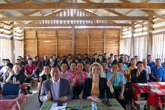
Nakai Village Celebrates First Land Titles in LMDP 3 Pilot Project

The Land Management and Decentralised Planning Phase 3 (LMDP 3) pilot project in Nakai village, Et district, Houaphanh Province, successfully concluded on 12 December 2024. This project supported all households in the village to obtain land titles, empowering the community to improve their livelihoods.
Nakai village is unique. The community, home to over 450 people from the Tai Dam ethnic group, is located in the heart of the National Forest Protected Area. Until recently, the villagers lived without land titles, facing challenges with land conflicts, and managing forestland. The LMDP 3 pilot project turned their hopes into reality by helping them secure land titles.
Phin Khamxay, a resident of Nakai village, expressed her joy upon receiving the land titles and emphasized their significance to her family. She said, “I’m so happy today because we finally have our land titles. Now, there won’t be any more conflicts with neighbours over our land. These titles prove the land is ours, and our children and future generations will always have it to farm. With the titles, we no longer have to worry about others claiming or selling our land.”
Khamyord Lorphonexay, a government representative from Houaphanh Province, shared how vital the Nakai pilot project is for national development. He said, "This project is a key example for other villages, and we can use what we’ve learned here to help more communities. Personally, as a technical staff member, I’ve gained invaluable knowledge from working with the villagers and partners, especially in using advanced mapping tools to document land titles."
Nakai village is one of the many successes of LMDP 3. During this third phase, the project empowered 2,223 households by documenting their land use rights, exceeding its original goal. It also supported Lao government partners develop citizen-centred legislation and policies in the land sector.
For decades, over 3,000 communities have lived in forested areas without clear legal recognition of the land they call home. But in May 2024, this changed. The National Assembly passed Resolution 57, officially recognising the land rights of these communities in forest areas, marking a major step forward for rural development. This achievement was made possible with the support of development partners, including the LMDP and the Mekong Region Land Governance (MRLG) project.
The LMDP project further supported this progress through years of collaboration and innovations. Over the past years, the project worked closely with government officials at both local and national levels to develop advanced land management tools. The LaoLandReg digital cadastre and the Land Use Information System (LUIS) were created to improve land management and categorise different types of land, especially forestland. Today, these systems are widely used in Laos, helping ensure land is used sustainably for the benefit of both local people and the environment.
As Phase 3 comes to an end, Phase 4 of LMDP is set to continue, building on the successes and lessons learned. Starting in 2025, the next phase will be co-funded by the governments of Germany and Switzerland.